Imphal West district (Meitei pronunciation:/ˈɪmfəl or ɪmˈfɑːl/) is one of the sixteen districts of Manipur state in northeastern India. As of 2011, it is the most populous district in the state.
Geography
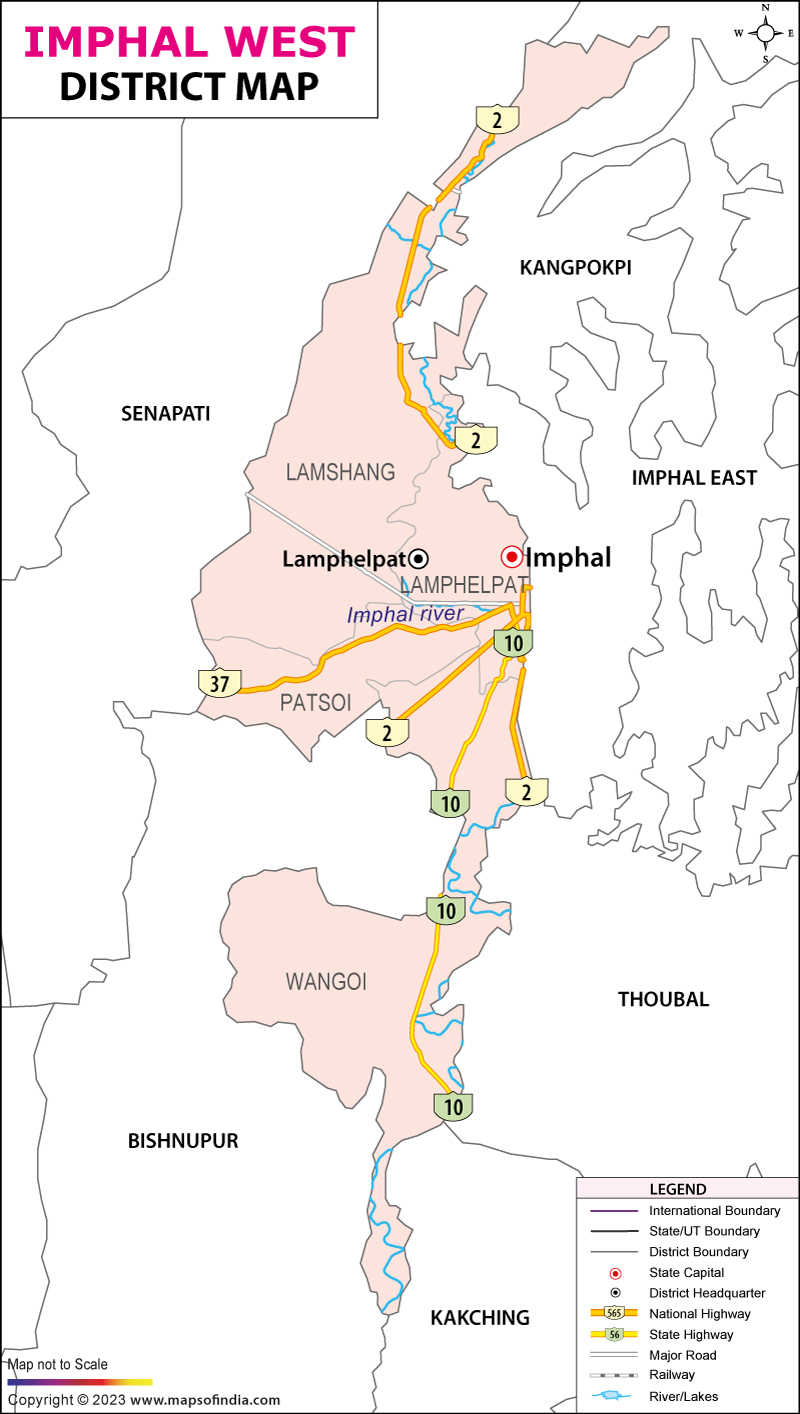
Lamphelpat city is the administrative headquarters of the district. The district occupies an area of 519 km2.
Economy
The district ranks first on the basis of "District Infrastructure Index " calculated under the patronage of Department of Development of North Eastern Region.
Demographics
According to the 2011 census, Imphal West district has a population of 517,992. This gives it a ranking of 545th in India (out of a total of 640). The district has a population density of 992 inhabitants per square kilometre (2,570/sq mi) . Its population growth rate over the decade 2001-2011 was 15.82%. Imphal West has a sex ratio of 1029 females for every 1000 males, and a literacy rate of 86.7%. 62.33% of the population lived in urban areas. Scheduled Castes and Scheduled Tribes make up 3.19% and 4.66% of the population respectively.
Languages
As per 2011 census, the main languages spoken in Imphal West district are Manipuri (470,852), Kabui (10,408), Nepali (10,391), Hindi (5,248).
Administrative divisions
The district is divided into 4 sub-divisions and 10 Circles:
- Lamphelpat Sub-Division: Lamphelpat
- Patsoi Sub-Division: Patsoi, Konthoujam
- Lamsang Sub-Division: Salam, Lamsang, Sekmai
- Wangoi Sub-Division: Hiyangthang, Lilong Chajing, Wangoi, Mayang Imphal
Areas under Imphal Urban Agglomeration
- Lamphelpat
- Patsoi
- Hiyangthang
- Lilong Chajing
See also
- Imphal Municipal Corporation
- List of populated places in Imphal West district
Notes
References
External links
- Imphal West district, OpenStreetMap, retrieved 14 August 2023.
- Official district government website


.jpg?Imphal_Valley1154553174)